


Benjamin Franklin's
political cartoon calling for colonial unity during the French and Indian War;
it would be used again during the American Revolution.
Dear
Families--
And so begins the next chapter of our study of American
History. By the 18th century, the colonies were established and growing.
Meanwhile, in Europe, European nations were fighting each other for land and
profit throughout the world. Various small wars continued for more than 100
years and became known as King William's War, Queen Anne's War, King
George's War, and, in North America, The French and Indian War, which
was fought to decide which nation, France or Britain, would become the
strongest power in North America. Begun as a regional conflict between the
French and English, The French and Indian War soon involved European alliances
on both sides and quickly escalated into what can be considered the First
World War. It relied heavily on its colonists and Indian allies to fight
and ultimately resulted in two outcomes--British control of much of North
America and an unexpected change in the way American colonists viewed
themselves. Tension between Britain and the colonists grew from the war and its
aftermath, and the [more unified] colonists began to think of themselves more
as Americans than as British subjects. Within a few short years, a new and
REVOLUTIONARY conflict would result.
Check out this video from a 1975 movie entitled
Barry Lyndon here. It shows the British military's "swaggering airs and
scarlet attire" as they rallied to resist what they considered to be the
French invasion of British territory. ("British Grenadiers" is the
name of the music that played as they marched.)

http://i.ytimg.com/vi/F6rZTu5jo7w/0.jpg
NOTE:
The British, dressed in bright red uniforms, maintained a formal way of fighting where they marched and fought in formation: when one man fell, another would rush forward to take his place. The French and Indians, and soon the American colonists, were adept at fighting from behind trees and bushes, which provided a distinct advantage in wilderness skirmishes and ultimately
revolutionized the way in which wars were fought.
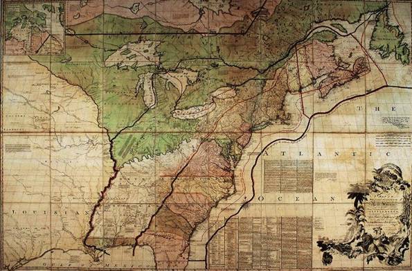
http://www.colonialwarsct.org/images/1689_fiwar_map.jpg
For those of you who
are interested, here are some authentic maps published in 18th century London
magazines. People then as now were intrigued by current events, and demanded the most up-to-date information.
By the middle of the eighteenth century, a number of
monthly magazines were being published in London. These magazines informed
their readers on a variety of subjects, including natural history, topography,
sports, and of course current affairs. The British public was fascinated by the
events of the war with France and so there was great demand for up-to-date
information, especially related to the American theater of battle. The British
magazines met this demand with articles and illustrations which they rushed
into print as soon as the details became available to them. The following maps
appeared in contemporary magazines published in London between 1758 and 1761.
These are among the most current illustrations of the events of the French
& Indian War which are available to us today.
This map, issued in the Gentleman's Magazine in
mid-1755, was published just before the war was declared. It shows "French
Incroachments" and includes detailed text explaining the British claims.
Also indicated are the numerous French and British forts in North America.
A map of the "English Colonies…bordering on the River
Ohio." This map was issued at the end of 1754, the year during which the
first shots were fired in the war. The war was sparked by a dispute over
control of the upper Ohio River, with the first engagement being George
Washington's fight with the garrison at Fort Duquesne (today's Pittsburgh). The
British reading public would want a map showing the lands in dispute. This map
shows those lands put into the context of the colonies extending from New
Hampshire in the north and the Carolinas in the South. The editors used a
somewhat out-of-date map.
This map focuses on the arena of fighting up to the spring
of 1757, just before the French capture of Fort William Henry. Forts under
British control are shown, including "Gen. Johnson's Camp" (Fort
William Henry), Fort Ann, Fort Nicholson, and Fort Edward. Forts depicted that
were under French control include Forts Oswego, "Frantunac", and
Frederick on Crown Point, as well as an indication of a "French
Camp" to the southeast of Fort William Henry. The detail of rivers and
towns is impressive, and color is used to indicate the political division,
including New Hampshire, which takes up the entire region now consisting of New
Hampshire and Vermont, as well as "Eastern Massachuset," a district
that was later to become Maine. The yellow color used for New York extends
almost as far north as Montreal and crosses to the north side of the St.
Lawrence River, with a note ("Extent of the French Settlements before they
built a Fort at Crown Point") indicating the British viewpoint that the
French claims to these lands were recent and unfounded.
A MAP OF THE COUNTRY BETWEEN CROWN POINT AND FORT EDWARD
This map is of the region around Lake George--from Crown Point on Lake Champlain to Fort Edward on the Hudson. It shows the forts in the region, including besides the two mentioned above, Fort William Henry and Fort Ticonderoga. Also shown are trails in the area, and a large body of "Drown'd Lands" along Wood Creek to the south of Ticonderoga.
This map is of the region around Lake George--from Crown Point on Lake Champlain to Fort Edward on the Hudson. It shows the forts in the region, including besides the two mentioned above, Fort William Henry and Fort Ticonderoga. Also shown are trails in the area, and a large body of "Drown'd Lands" along Wood Creek to the south of Ticonderoga.
"Because dense forests made overland travel in North America very
difficult, Indians and Europeans used waterways whenever possible. Between the
St. Lawrence River (Montreal) and the Hudson River (Albany), several smaller
rivers and lakes enabled fur traders, missionaries, and soldiers to travel by
canoes and bateaus. Lake Champlain, the longest of these waterways, provided a
link between the two major rivers. Although the French dominated the northern
end of the lake, the southern sector and Lake George remained in contention. In
1755, the governor of Canada ordered the construction of Fort Carillon
(Ticonderoga) at the place where travelers had to move overland between Lake
Champlain and Lake George. Sir William Johnson responded by erecting Fort
William Henry at the southern tip of Lake George."
I will continue to share our learning--
Teri
P.S. For more information on the Who/What/When/Where of the French and Indian War, check out Social Studies for Kids.
P.S. For more information on the Who/What/When/Where of the French and Indian War, check out Social Studies for Kids.